
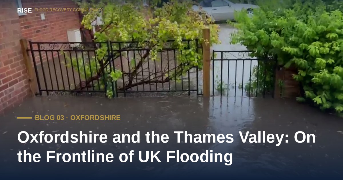
Storm Henk in January 2024. The wettest calendar month since 1836 in September 2024. Persistent flood alerts in early 2026. A major Oxford alleviation scheme still years from completion. Oxfordshire sits at the heart of the Thames Valley — and at the frontline of UK flooding.
Published June 2026 · RISE Flood Recovery Consultancy
In January 2024, Storm Henk swept across England. In Oxfordshire, the county council described scenes consistent with being on the frontline of UK flooding. Eight months later, September 2024 became the wettest calendar month Oxfordshire had ever recorded — in a county rainfall series dating back to 1836. The Met Office confirmed the figure was 374% of the September average. At Oxford's Radcliffe Meteorological Station, it was the wettest single month since 1774.
These were not isolated incidents. Councillors described a shift from sporadic flooding every few years to multiple sequential clusters — and warned that the next step could be continuous flooding over extended periods. Then, in mid-January 2026, persistent rainfall returned. Flood alerts were issued across the Thames, the Windrush, the Evenlode, the Ock, the Thame and the Ray. They remained in place for weeks.
This article examines what flood risk looks like in Oxfordshire today — the rivers, the surface water, the chalk aquifers that fill silently for months. What the council is doing about it. And what every Oxfordshire homeowner can do this week.
Oxfordshire sits within the Thames River Basin — one of England's largest and most complex river catchment systems. The Thames, Cherwell, Evenlode, Windrush, Thame and Ray all flow through or border the county, each carrying rainfall from upstream catchments into the Oxford basin.
Oxford itself sits at the confluence of multiple watercourses in a natural floodplain. The city has a long history of flooding — from the 2007 county-wide floods that saw mass evacuations across Oxford, Abingdon and Witney, to the groundwater flooding that affects properties in low-lying areas of West Oxford when chalk aquifer levels rise.
High-risk areas include Abingdon, Banbury, Henley-on-Thames, Kidlington, Wallingford, Wantage, Witney and Dorchester — all with properties in Environment Agency Flood Zone 3, meaning they face an annual flood probability of 1 in 100 or higher from rivers.
Urban areas including Banbury and Oxford city centre face increasing risk from surface water flooding — rain falling faster than drainage can cope with. As development continues and impermeable surfacing expands, the proportion of rainfall that runs off rather than soaks away increases. The drainage systems beneath these towns, much of it Victorian, was never designed for the rainfall intensities now becoming normal.
Oxfordshire County Council's Local Flood Risk Management Strategy, refreshed in early 2025, explicitly acknowledges the shift. The county needs to move from a reactive posture to a proactive one, the strategy warns — or the economic and social losses will spiral to an uncontrollable level.
Oxfordshire's groundwater flood risk is significant and often underestimated. The county sits over chalk and limestone aquifers that absorb rainfall over weeks and months, releasing it slowly as groundwater levels rise. Properties in areas like West Oxford can find water rising through floors and walls long after surface water has receded.
Groundwater flooding is harder to predict, harder to insure against, and harder to recover from. It does not follow river channels — it follows geology. And it can last weeks or months, far longer than surface water or river flooding.
The British Geological Survey has confirmed that during major flood events in Oxford, groundwater is often the primary or contributing cause of property damage — not the river overtopping its banks alone.
For more than a decade, the Environment Agency has been preparing a major flood alleviation scheme for Oxford — a programme of upstream water storage, channel widening and natural flood management designed to reduce river flood risk to thousands of homes and businesses across the city.
In May 2025, the Secretary of State approved the scheme's Compulsory Purchase Order, allowing the Environment Agency to acquire the land needed for construction. A construction partner is now being selected. Construction itself is expected to begin in late 2026 — and the works will then take years to complete.
In the meantime, Oxfordshire County Council opened a new round of community flood grants in March 2026, funding small-scale local interventions led by parish councils, flood groups and catchment partnerships. In the previous financial year, more than £500,000 was awarded across nearly 40 schemes. It is meaningful work. But the gap between what communities can deliver locally and the scale of infrastructure required to address county-wide risk is widening, not closing.
Public investment in flood infrastructure is reactive by nature — it follows demonstrated harm, not anticipated risk. The 2007 county-wide floods, the Storm Henk floods of January 2024, the record-setting September 2024 rains, the prolonged flood alerts of early 2026 — each event has been catalogued, investigated, and used to justify the next round of funding. By the time a scheme reaches construction, the homes that drove it onto the funding queue have already flooded. Sometimes more than once.
Three things every Oxfordshire homeowner can do in under thirty minutes — and most never have:
Check your property's flood risk on the updated NaFRA2 data. The Environment Agency's free service at check-for-flooding.service.gov.uk was updated in January 2025 with higher-resolution modelling and the latest climate projections. The new assessment treats surface water risk far more seriously than the previous one. If you have not checked since then, your property's official rating may have changed.
Sign up to Environment Agency flood warnings. Free, by phone, text or email. The county's main rivers — the Thames, Cherwell, Windrush, Evenlode, Thame, Ock and Ray — are all covered by the warning service. Coverage is for main rivers only, so surface water and groundwater flooding still require you to read the weather and act on your own observations.
Look up flood investigation reports for your area. Oxfordshire County Council publishes its Section 19 flood investigations on the Oxfordshire Flood Toolkit. The most recent investigation, published in January 2026, examined the Storm Bert flooding of November 2024 at Eynsham — identifying the old A40 bridge as a pinch point that caused the Chil Brook to spread across the floodplain and flood five properties. If your area has flooded in recent years, the cause may already have been investigated and documented. (See the Section 19 Reference Manual for the full statutory framework.)
Sources and further reading: Met Office, Record-breaking rainfall for some this September (October 2024); University of Oxford, Radcliffe Meteorological Station data (1767–2024); Oxfordshire County Council Local Flood Risk Management Strategy (refreshed early 2025); Environment Agency, Oxford Flood Alleviation Scheme updates (May 2025 CPO approval); Oxfordshire County Council news, Community Flood Grant scheme (March 2026); Oxfordshire Flood Toolkit, Section 19 investigation reports.
No obligation. No jargon. By the end of the call you will know exactly where you stand — whether you engage RISE or not.
Available 24 hours, 365 days No callback RISE directly
Live data from the Environment Agency, refreshed every 15 minutes.
Help us focus future content
RISE is researching gaps in publicly available flood recovery information. If you have 90 seconds, your responses help us understand what homeowners actually struggle to find clear answers on — and shape what we write next.
Take the 90-second survey →